Atypical Curves Last update : 2024-02-06 Publisher Michelin Mobility Intelligence Scope France Identify the risk profile of curves to anticipate the works to be done before accidents happen.
Crash Probability Hotspots Last update : 2024-02-06 Publisher Michelin Mobility Intelligence Scope USA Identify and rank, by crash probability indicator, hotspots within your road network.
Detailled driving events Last update : 2024-02-06 Publisher Michelin Mobility Intelligence Scope USA, France Get detailed information on driving events within your road network.
Driving Events Last update : 2024-02-06 Publisher Michelin Mobility Intelligence Scope USA, France Detect, locate, and count driving events within your road network.
Origin-Destination Flows Last update : 2024-01-29 Publisher Michelin Mobility Intelligence Scope Europe, USA Thanks to our origin-destination datasets, adapt your business activities to the recorded vehicle traffic in a specific area
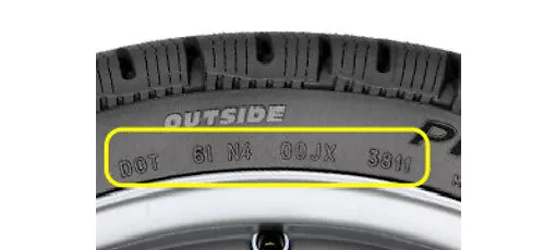
Tire DOT Recognition Last update : 2023-12-22 Publisher Michelin Scope Worldwide Improve your tire stock management using our automatic DOT recognition API
Automated Tire Inspection Last update : 2023-12-05 Publisher Michelin Scope Europe Get tire inspection results on remarketed cars
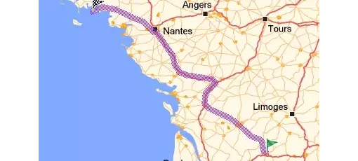
Itineraries by City Last update : 2024-01-19 Publisher Michelin Scope Europe Analyze expected journey flows from or to a specific city or department