Harsh Braking
Description
Description
Paving the way toward vision zero with MICHELIN DDi Near miss service suite
Combining expertise in data analysis and driving behavior, MICHELIN DDi creates solutions to go beyond crash data reports allowing you to act before accidents happen. Leveraging millions of connected vehicules and using machine learning and proprietary algorithms, our near miss services suite allows road safety officials to detect, locate and assess atypical driving behaviors indicative of potential near miss incidents.
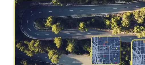
Our ‘Harsh Braking’ service allows you to identify and locate where and when sudden and atypical acceleration events occurred. The presence of sudden acceleration often indicates a risk of surprise from the driver and therefore a potential ‘Near Miss’ incident.
Key Features:
- Atypical harsh braking driving events clusters
- Weather, solar and day of the week contextualization
- Filtering by road features and driving events
- Before/after comparisons
- Compatible with any GIS
Product sheet
Product sheet
file_download
Download
Benefits
Benefits
Why use Michelin DDI 'Harsh Braking' service?
LEVERAGE DATA INSIGHTS
Based on millions of connected drivers, understand where and when road safety issues may arise tackling atypical driving events to complement past crash data.
Integrate easily
All information slips onto geographic information systems, enhancing other data sets and with no other infrastructure requirements.
Allocate resources
Justify and allocate the right resources at the right time and place based on a easily measurable new safety KPI.
before/after ANALYSIS
Monitor and quickly valorize your actions through before / after analysis that you can create independently directly on your GIS.
Usecases
Usecases
How does it work? How will you be able to use our service?
LOCATE DRIVING EVENTS
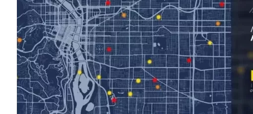
Our dataset includes events that can be visualized on your GIS via GPS points, you can then pinpoint exactly where potential risky zones are located on your road network.
UNDERSTAND EVENT CONDITIONS
More than just identifying the location, we also provide the different contextual parameters such as date and time of the day and weather conditions. You are then able to analyze patterns and benefit from actionable insights.
MONTHLY TRACK AND REPORT PROGRESS
Thanks to the monthly data updates, one can track progress with KPI-based facts and report proof of improvements.
The output?
A game-changing perspective to go beyond past crash data. With near miss data comes the potential to identify risky zones and act before crashes occur to reach vision zero goals.
Want to know more? Have a look at our Driving Events service gathering multiple atypical driving events.
Related products
Dataset Features Definition
Dataset Features Definition
| title | description | type |
|---|---|---|
| arc_index_hash | Arc Key for road map matched with OpenStreetMap. Linestring which designs a portion of the road with a specified direction. An arc can be referenced with a point of interest like a Stop or a Yield | string |
| month_start_date | Month aggregation | Date |
| context_week_period | Week Context aggregation. Depends on the day of week that the event(s) occur(s). Weekends are Saturday and Sunday, all other days are designated as Week. | String |
| context_weather_simplified | Weather Context aggregation. We use the the rain precipitation. If it's greater than 0 we consider that it's raining. Otherwise it's considered Dry. | String |
| context_solar_condition_simplified | Solar context aggregation. We use the solar position calculated by the GPS position and timestamp: DAY and NIGHT. | String |
| event_type | Events occurring during trips with intensities above the observed norms. If empty, no event occured on the arc during context combination | String |
| event_level | Event intensity calculated base on speed and acceleration variation and duration | String |
| nb_events | The number of events occurred for associated contexts. For Suspected Collision Event type, this value is 1. | Integer |
| arc_geom_wkt | Arc geometry (WKT format). First point represents the start of the line and the last point represents the end. It models the part of road (by a line) where events appear (https://wiki.openstreetmap.org/wiki/Way#Open_way_.28Open_polyline.29). | String |
| arc_length | Arc length (in meters) | Decimal |
| country_code | Country code | String |
| country_name | Country name | String |
| department_or_county_code | County code. GNIS Code. | String |
| department_or_county_name | County name | String |
| zip_code | Zip code | String |
| city_name | City name | String |
| state | State name | String |
| state_id | State identifier | String |
| road_name_european_or_interstate | Column for Interstate Highways | String |
| road_name_highway | Column for US routes | String |
| road_name_region_or_state | Column for State Routes | String |
| road_name | Column for Road Names | String |
| road_name_department_or_county | Column for County Routes | String |
| road_name_national_or_federal | Column for Federal Roads | String |
Quick Start guide
Quick Start guide
Prerequisites
An active account either with " Freemium " subscription (number of requests is limited to 5), or a " Business " subscription to the selected service.
Use of the APIs
The use of all our APIs is subject to the use of a user token. To obtain this token, it is necessary to authenticate by an API call.
The authentication allows to get the user token which will be requested in all the API calls.
The url to use: https://api.ddi.michelin.com/ddi/auth/token
Input parameters:
- grant_type: Type of grant. The only accepted value is “client_credentials”.
- client_id: Your customer id. You can find it in your account page (sample: zbQZOqNEAlKuL[…truncated sample..]0K07AyOk).
- client_secret: Your secret password. You can find it in your account page (sample: BZGn8fZu[…truncated sample…]).
Sample using Curl:
curl –-location --request POST 'https://api.ddi.michelin.com/ddi/auth/token'\
--header 'Content-Type: application/x-www-form-urlencoded'\
--header 'Accept: application/json'\
--data-raw 'grant_type=client_credentials&client_id= zbQZOqNEAlKuL[…truncated sample..]0K07AyOk&client_secret= BZGn8fZufqXXXXXX'
Then, the token must be added in the header of the request:
curl --location --request GET 'https://api.ddi.michelin.com/risky_turns/turns?distance=1&long=3.05167&lat=45.9153'\
--header 'Accept: application/json'\
--header 'Content-Type: application/json'\
--header 'Authorization: Bearer eyJraWQiOiJxMXl2M[…truncated sample…] EnWxN67fggh1Q'
Sample using Swagger:
1. Select POST /ddi/auth/token and click on “Try it out”
2. Fill in the input parameters specified above
3. Execute to get your token within the response as below:
{
"token": "eyJraWQxMXl2[…truncated sample…]nWxN67fggh1Q"
}
4. Select the “Authorize” button on the top right corner of the Swagger:
5. Copy and paste the token in the field before validating.
The token will then be automatically used in all API requests.
We recommend you to use the paths below for the first tests:
Authorized parameters using Freemium access
countryCode = US
stateCode = UT
cityCode = 84044, 84108, 84119, 84116, 84109
periodStart = 2020_01
periodEnd = 2020_01
Trial & Pricing
Get a free sample dataset
Use our freemium tier to explore our insights and test all functionalities for free to start building today !
Real data sample
5 calls
3 months trial period
Let's get started: Use our mobility data as part of your road safety strategy and benefit from support !
Real data
Unlimited calls
Monthtly updates


